There are two levels of flood mapping that have been updated recently:
- Province of Alberta Flood Hazard Map
- City of Calgary Regulatory Flood Map (DRAFT)
Provincial Flood Hazard Map
Over the last few years the Government of Alberta (GoA) has invested significant time and effort into producing updated flood hazard area maps for the river basins in the province. The default, or design flood mapping criterion is a 1 in 100-year flood (i.e., a 1% chance of occurrence) for any particular river basin, though more severe floods of 1:200 and 1:500 were also evaluated. These maps are important to inform residents about their level of flood risk, and for the City for planning purposes. They are available at floods.alberta.ca.
The new terms for the various designated flood zones, from the website floods.alberta.ca, are as follows (with this author’s comments in italics):
Flood hazard area
The flood hazard area is the area of land that will be flooded during the 1:100 design flood. It is typically divided into two main zones, the floodway and the flood fringe, and now also includes additional flood fringe sub-zones. Depending on when a flood study was conducted, the flood fringe can also include high hazard flood fringe, protected flood fringe, or overland flow (flood fringe) sub-zones. These are summarized below in decreasing order of risk.
Floodway
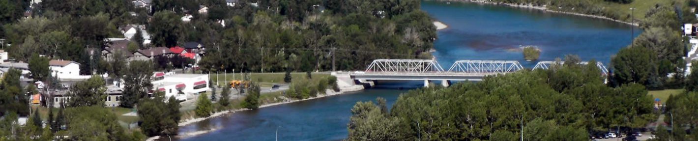
The floodway typically represents the area of highest hazard, where design flood flows are deepest, fastest, and most destructive. When flood hazard maps are updated, the new floodway may not change and may be the same size as the previous floodway, even when the flood area gets larger, to help maintain regulatory certainty for landowners. (In Bowness, it can be observed from the maps that a slight area expansion of the floodway area occurs along most of the river course, with the exceptions being Bowness Park and Bowmont Park, where much of their areas will be within the floodway during a 1:100 flood event).
High hazard flood fringe (flood fringe sub zone)
The high hazard flood fringe identifies areas within the flood fringe with deeper or faster moving water than the rest of the flood fringe. The high hazard flood fringe may be more commonly found in communities with updated flood hazard maps, as the distinction has only begun to be included in more flood hazard maps in the newer flood studies. (For the Bow River in Calgary, the high risk flood fringe areas are defined as those where overland flows are greater than or equal to a depth of 1 meter and/or a flow rate of 1 meter/second. Certain areas at both the east and west ends of Bow Crescent are mapped as high hazard flood fringe, although flow depths and velocities can vary substantially, as was observed in 2013).
Flood Fringe
The flood fringe is the part of the flood hazard area outside of the floodway. When early flood hazard maps were produced, water in the flood fringe was simply considered to be that which was shallower and flowing more slowly than in the floodway. Newer studies may separate the flood fringe into the sub-zones of high hazard flood fringe, protected flood fringe, or overland flow. (Within Bowness, much of the area proximal to the Bow River itself lies within the flood fringe area for a 1:100 event. The 2013 flood is now considered to represent a 1:75 year flood event).
Overland flow (flood fringe sub zone)
The overland flow (flood fringe) is a legacy flood fringe sub-zone that identifies areas where flooding is expected, but where there is uncertainty about flood levels and water depths. These areas are only defined in a small number of older flood studies and will be phased out as those studies are updated and replaced.
Protected flood fringe (flood fringe sub zone)
The protected flood fringe identifies areas that could be overland flooded if dedicated flood berms fail or do not work as designed during a 1:100 design flood. These areas are not expected to be overland flooded but reflect areas of residual risk, including groundwater flooding. Protected areas can be different for floods smaller or larger than the design flood. (Certain areas of Hillhurst/Sunnyside will lie within areas designated under this new category once the Sunnyside barrier project is complete).
One shortcoming of the new maps that is relevant to Bowness residents is that they do not account for the decreased flood risk provided by the TransAlta Modified Operations Agreement (the “TA agreement”) now in place between TransAlta and the province of Alberta. This agreement, in force during a defined flood season, provides up to 65 million m3 of storage for flood mitigation. As this is less than half of what would have been required to attenuate even a 2013 size (1:75 year) flood, the Province has recently approved the expansion of the Ghost Reservoir by another 35 million m3. Notwithstanding this, the TA agreement does afford Bowness protection up to about a 1:30 year flood event risk. The current agreement expires in April 2026 but is renewable every 5 years.
Additional upstream storage options for both future flood and drought mitigation are currently under review by the Province.
City of Calgary Regulatory Flood Map
In November 2025, the City released a draft Regulatory Flood Map that incorporates the Floodway, High Hazard, Flood Fringe and Protected Flood Fringe zones from the Provincial Flood hazard mapping. The City’s map also introduces a Groundwater Flood Fringe to identify the risk of groundwater flooding that is not addressed in provincial mapping.
The City’s draft Regulatory Flood Map, and address search function, can be found here:
Why These New Maps are Important to Homeowners
It is imperative that those living in flood risk areas be aware of the potential flood risks, which may entail significant financial losses, or even loss of life. This is particularly true in the case of families who may move to a community without realizing that their new home lies in a flood risk area, or in cases where the first-floor elevation of the home lies below the projected 1:100 year flood event water depth. For example, it is surprising how many streets in Bowness have a high risk of future flood damage from overland and/or groundwater flooding despite being hundreds of meters from the Bow River.
Changes to Land Use / Development Rules
Through the Calgary River Valleys Project (CRVP), the City of Calgary is in the process of modifying existing planning policies, and developing land use (zoning) regulations to ensure that future infrastructure, dwellings, and communities are safer and more resilient with regard to future flood events. Significant changes to building regulations are being proposed and are scheduled to go to the City Council Committee in early 2026.
It is important to be aware of potential land use changes to residential or neighbouring properties, as they may affect how residents use, renovate, or build on their properties as well as future resale value.
The informative CRVP website includes:
- a video of the online Virtual Info Session that identifies the significant proposed changes to Calgary’s building regulations for each flood zone;
- a link to the City’s draft online interactive version of Calgary’s proposed Regulatory Flood Map, including the introduction of the City’s new Groundwater Flood Fringe (where you can search your address); and
- an extensive list of helpful FAQs
Please see:
https://www.calgary.ca/water/flooding/calgary-river-valleys-project.html
Home Insurance
Historically, risks of this nature have been mitigated through the acquisition of home insurance. Since 2013, however, increasing numbers of home insurance policies do not cover water damage. The updated Alberta government flood hazard maps now contain an additional designation, “High Risk Flood Fringe”, which did not exist on previous maps. As can be seen on the updated map, there are many homes in Bowness that lie within this newly designated area. It is conceivable that insurance companies, increasingly sensitive to climate change risks, will now refuse to insure properties lying within this flood risk zone, or that this coverage will simply become prohibitively expensive, increasing financial risks to homeowners.
The City of Calgary recognizes that properties within the high-risk flood fringe zone may either be subject to high depth water, high velocity flow, or both, and that these entail different flood damage risks. The “Calgary River Valleys Project” (CRVP) https://www.calgary.ca/water/flooding/calgary-river-valleys-project.html states:
“When a High Hazard Flood Fringe Area is only deep (not fast) and, particularly, when it is surrounded by the Flood Fringe Hazard Area, the overall flood risk is lower. The City of Calgary is choosing to look carefully at this distinction within the high hazard flood fringe, to ensure that updated regulations are in line with the flood risk. Historically, these areas would have been mapped as floodways, but because this designation is the most restrictive and has significant implications on developability, in established communities, the province has designated these areas as High Hazard Flood Fringe instead of Floodway. This allows municipalities more flexibility in how these areas are regulated, to continue to function as thriving communities”.
Groundwater Flooding Risks
It is important to note that the updated provincial Flood Hazard Maps do not include an assessment of the groundwater flooding risk in Calgary. To assess and commuicate this risk, the City has developed a new groundwater risk overlay based on the Calgary River Valleys Groundwater Study, which maps groundwater levels during flood events and identifies areas of risk. This will help inform planning changes with respect to groundwater flooding and areas of risk.
Engineering studies completed by the City of Calgary in 2021 showed a significant groundwater flooding risk in Bowness specifically over a wide area encompassing hundreds of homes, even if a surface flood barrier were to be in place. It is for this reason that both the Bowness Responsible Flood Mitigation Society and the Calgary River Communities Action Group are advocating that the GoA provide sufficient upstream flood mitigation infrastructure to limit the flow rate on the Bow River though Bowness to 800 m3/s for a 1:100 year flood event. Providing this flow limit will protect the community from both overland and groundwater flood damages, just as the recently completed Springbank Off-Stream Reservoir (SR-1) is now protecting communities on the Elbow River in Calgary.