BRFM strives to provide accurate information to residents of Bowness and our members. Our published data is backed up by references and information is provided in a clear format.
Some of our information was obtained through Freedom of Information (FOIP) requests to the City of Calgary. If members would like to read information BRFM has obtained through FOIP requests, please email info@bownessrfm.ca.
A: The City originally published 12% (1 in 8 years). This is based on no Dams. Dams have been in place since the early 1900s. At BRFM’s request, the City has updated their published risk to be 5% and is located at Bowness Flood Barrier FAQ https://www.calgary.ca/planning/water/bowness-flood-barrier-faq.html
The Province of Alberta has previously informed BRFM that the risk is 5%. And an interpolation from the city-commissioned Associated Engineering (AE) report (Permanent Flood Barrier Assessment, April 2018), results in a risk of 3.7%. (Table 6-3 AE report)
A: No. The 2013 flood was estimated to be a 1:75 year event and the City’s berm design requirement is for a 1:20 event. The 2013 flood would have overtopped this design and there will also be groundwater flooding as documented in the City commissioned report by Klohn Crippen Berger.
A: As the river rises, the water table inland below the surface rises due to porosity of the strata near the river. The proposed berm (which does not go to bedrock) cannot stop the rising of the river inland through the ground. The AE report has different flood scenarios with and without the berm. The vast majority of houses that would be overland flooded without the berm will be flooded by groundwater with the berm. (Page 104)
The City commissioned the engineering firm, Klohn Crippen Berger, to perform a Groundwater Study that confirmed the same. The 2021 study can be found on the City website at https://www.calgary.ca/planning/water/community-flood-barrier-related-studies-and-reports.html
Projected Groundwater flooding maps from the 2021 study overlaid with street addresses can be found at www.bownessbarrier.ca
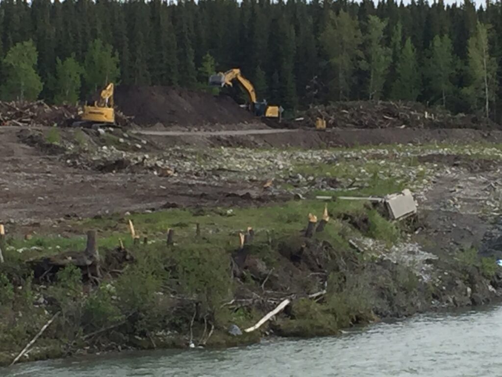
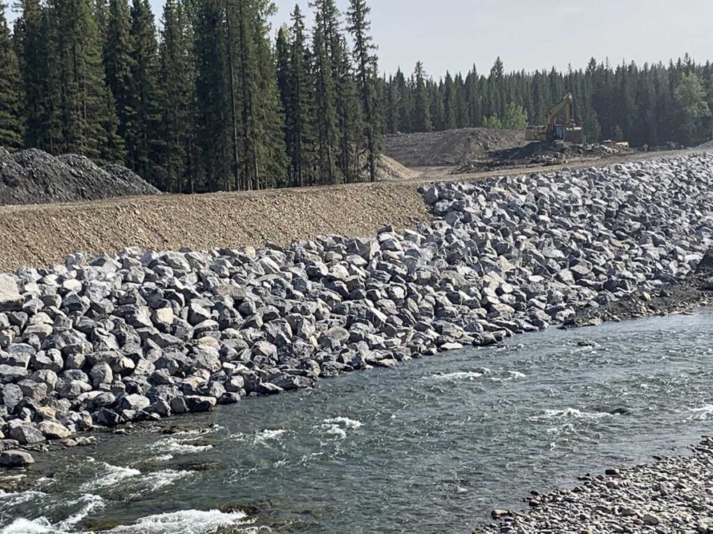
A: Yes. Based on the recent construction of flood barriers in Bragg Creek, one can expect similar disturbance as shown in the photos taken in the summer of 2020 and 2021.
In addition, BRFM performed a tree inventory on the original proposed berm and estimated a loss of approximately 3500 trees. Although the path of the berm is not finalized, if The City puts up a berm or a wall, there will be a significant loss of trees. Trees are not allowed to be replanted on a berm.
A: The Bowness Barrier Project has been put on hold awaiting the results of the Province’s Feasibility Study of three potential upstream reservoir sites (Bow River Reservoir Options Project). While the City’s project has been put on hold, it has not been cancelled.
It is our understanding that the members of the City project team were reassigned to other projects.
A: In September 2024, the Province selected the Relocated Ghost Dam as the option to take into Phase 3 of the Bow River Reservoir Options project (BRRO). Phase 3 is the engineering and regulatory approvals process, which commenced in 2025. More information on the Bow River Reservoir Options Phase 3 can be found at https://www.alberta.ca/bow-river-reservoir-options.aspx
BRFM is advocating for upstream mitigation that has the capacity to reduce the water flow rate on the Bow River to a maximum of 800 m3/s, which is when ground water flooding begins to occur in Bowness. The scope of Phase 2 of the BRRO was to evaluate three options with a target maximum flow rate on the Bow River of 1230 m3/s. BRFM takes the position that such a high flow will not protect Bowness from groundwater flooding and allows for very dangerous conditions on the river. It is currently unknown whether Phase 3 will consider a maximum peak flow rate of 800 m3/s.
A: In May 2025 the Province completed the construction of SR-1, a dry reservoir designed to hold water during a flood emergency. SR-1 is for the Elbow River and does not protect Bowness and other communities along the Bow River upstream of the Elbow River confluence.
A: Yes, the TransAlta Agreement lowers your flood risk on the Bow River. The agreement allows the Province of Alberta to set elevations on the Ghost Reservoir during the period of May 16 to July 7 until 2026, which is typically the highest storm risk period of the year. By keeping the reservoir lower during this period there is more space to store flood events thereby lowering peak flows downstream of the dam or, at the very least, delaying those peaks.
For more information refer to the TransAlta Agreement Fact Sheet at: https://open.alberta.ca/dataset/d0ee8794-b79b-4bd6-b50a-210c9af60104/resource/f27e24b0-303c-4d01-8467-88b21ef8619e/download/aep-bow-river-transalta-agreement-fact-sheet-2022-02-23.pdf